
OVERVIEW
About the Project
Integrates GPS technology onboard the mobile device to provide the App users with near real-time, location-based service (LBS) environmental information. The messaging technology is also employed to push subscribed information based on the LBS from the Environmental Protection Administration (EPA) server to deliver near-real-time environmental alert messages to the users.
-
Role:
UI/UX Designer -
Tools:
Sketch, InVision -
Client:
EPA -
Timeline:
May 2015-July 2018
ACHIEVEMENT
Outcomes
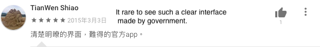
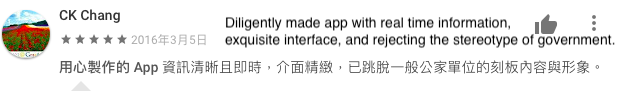
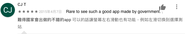
Unlike most projects hold by government sectors usually get negative feedback, the public is highly satisfied with the Environment Info Push App because of its user-friendly interface and useful outdoor activity tips. The app won 4.4 rating by thousand users, and has been installed on almost 300,000 devices.
I. Integrate 8 different air quality indices
II. Offer 1/7/30 historical data in easy-to-understand trend chart
III. 4.40 rating by thousands of users
IV. Over 360,000 devices installed
V. 20,000 devices online to access the service during peak time
Ratings
Here are some screenshots that show that people like our app. The most popular topic that people are talking about is that it is rare to see such a useful app with a sense of design developed by the government.


GOAL
The Challenge
To face the serious environmental pollution issue, the highest governmental sector, Taiwan EPA, has devoted to providing various public services and integrated information around the country for a better living environment. Environment Info Push App was therefore proposed to serve the public with air quality indices, weather info, and outdoor activity suggestion.
RESEARCH
The Solution
As EPA is the main and the highest government sector for environmental protection that has the authority to access data to nationwide observation stations, all they need was to build a suitable platform for the public to display all the information within one user-friendly and easy-to-use app on Android and iOS devices. I was authorized to develop Environment Info Push App due to my rich experience in providing clients with professional environment-related geospatial solutions.
IDEATION
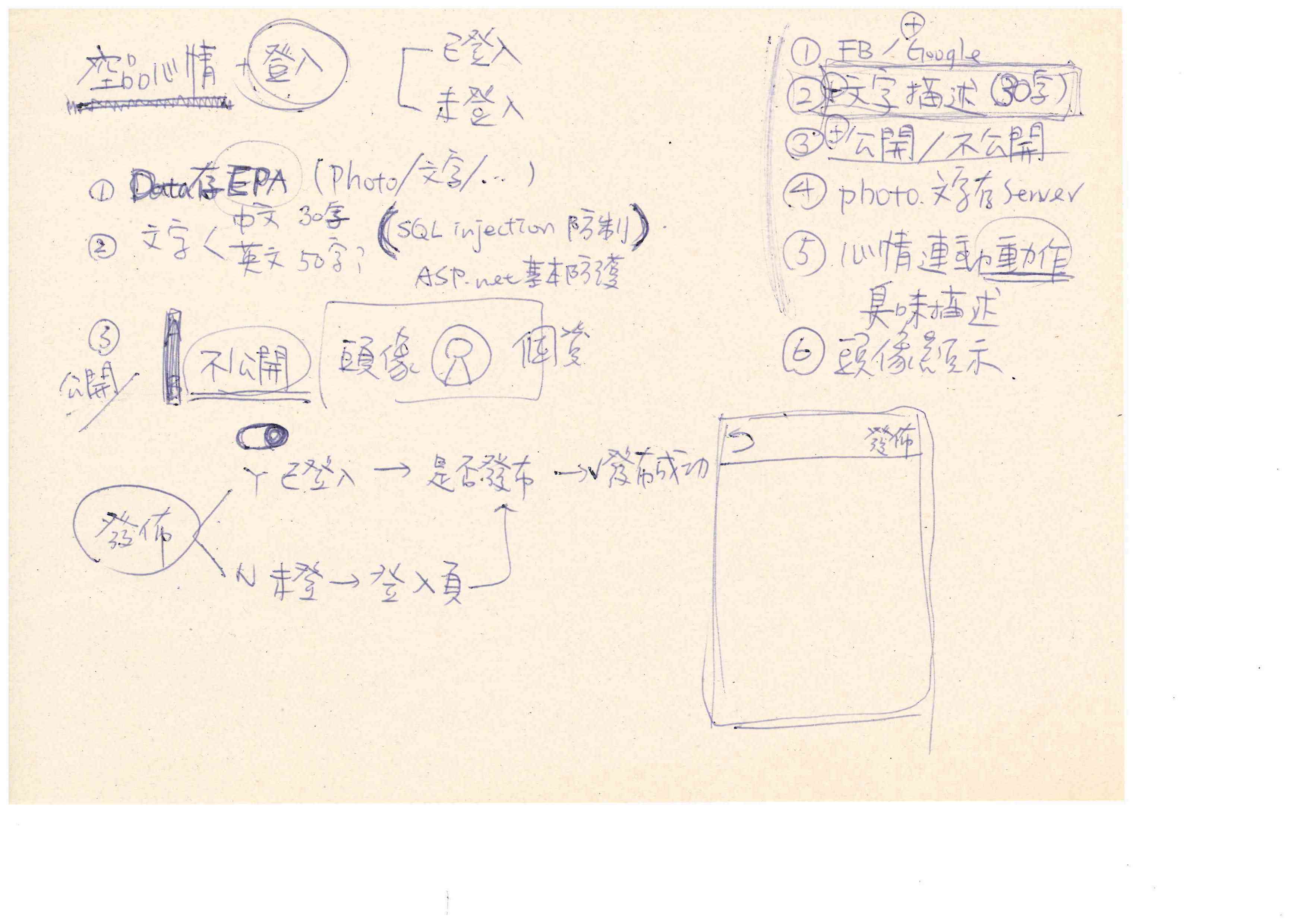
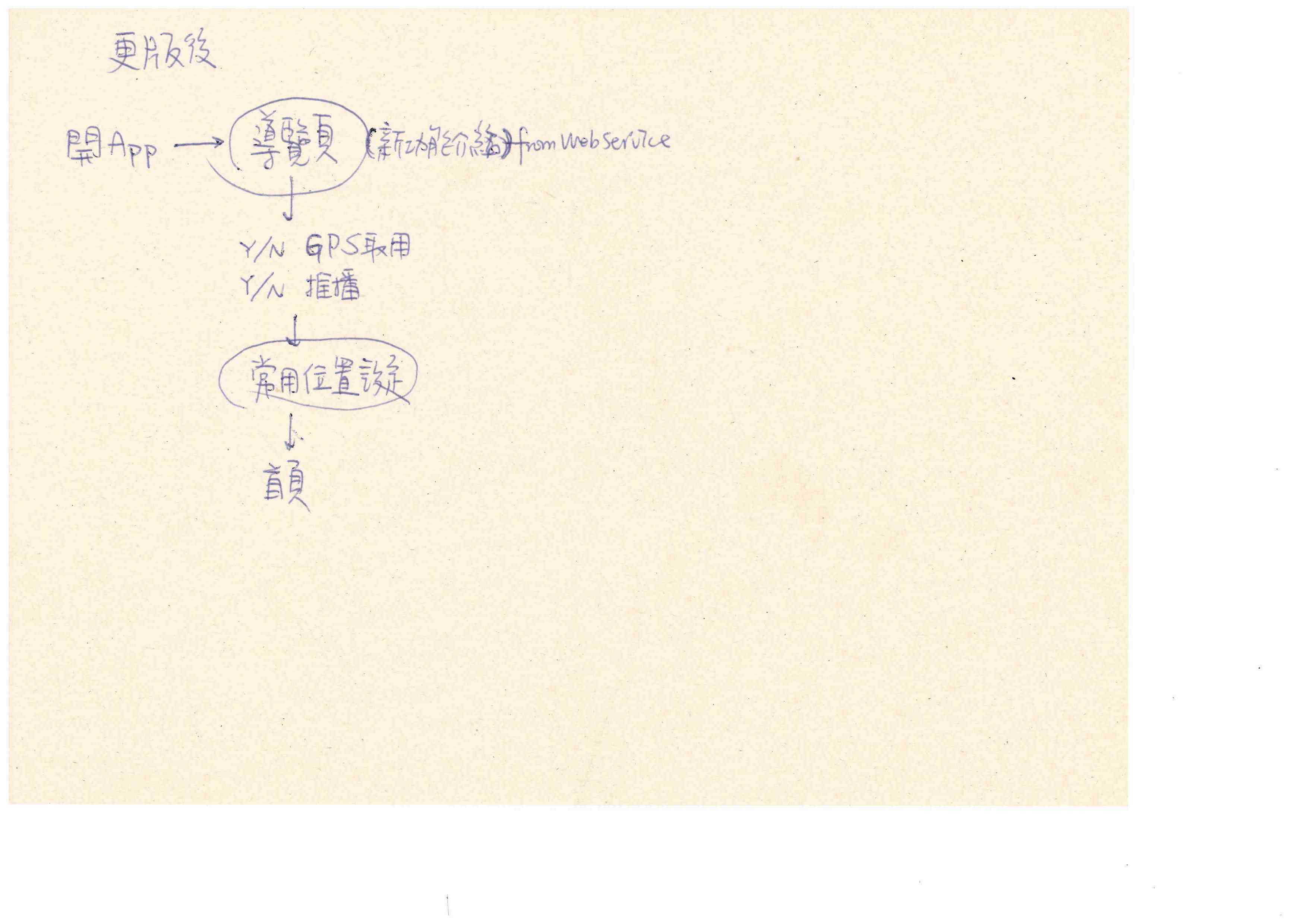
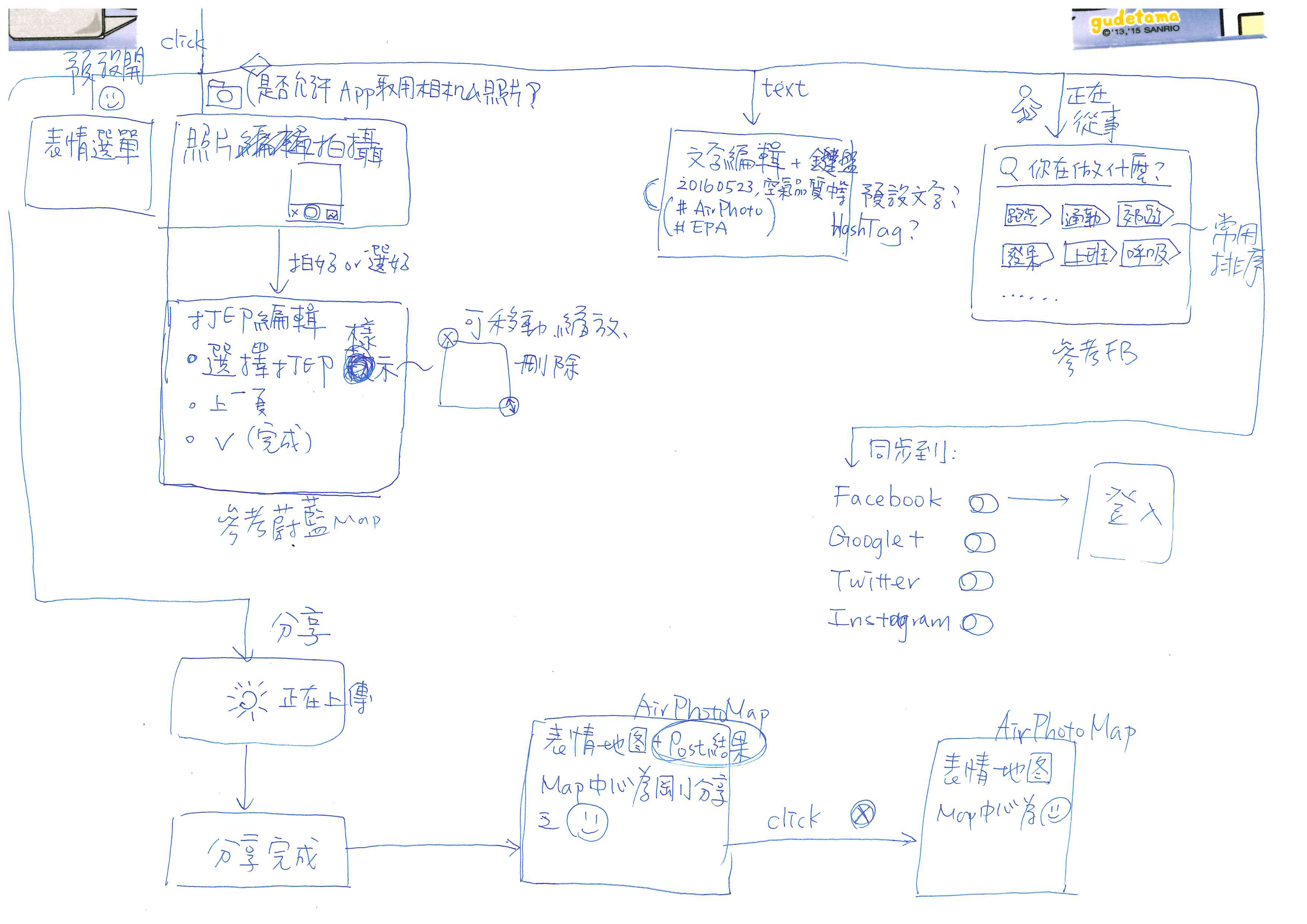
Concept Sketching
-
Functional Map

-
Sketch
-
UI Flow

-
Flow Chart
-
Cognitive Walkthrough

-
Prototype
IMPROVEMENT
Visual Design Process
-
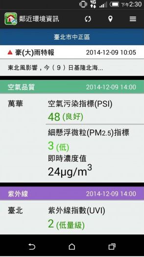
v 1.3.3 (Before Refinement)
-
v 2.0.1
-
v 2.2.9
-
Newest
HIGH-FIDELITY PROTOTYPE
UI Flow
-
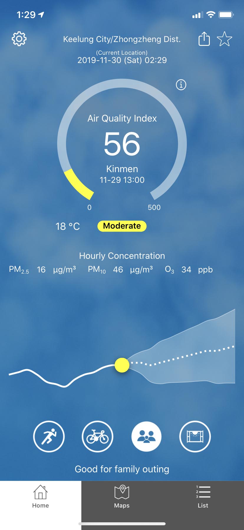
Home-General Group Activities Suggestions
-
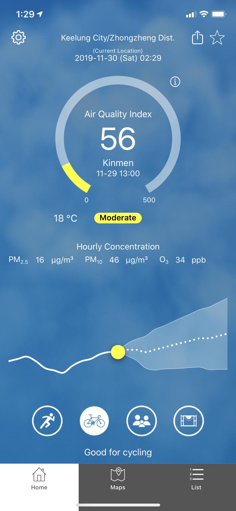
Home-Outdoor Activities Suggestions
-
Home-Susceptible to Air Quality
-
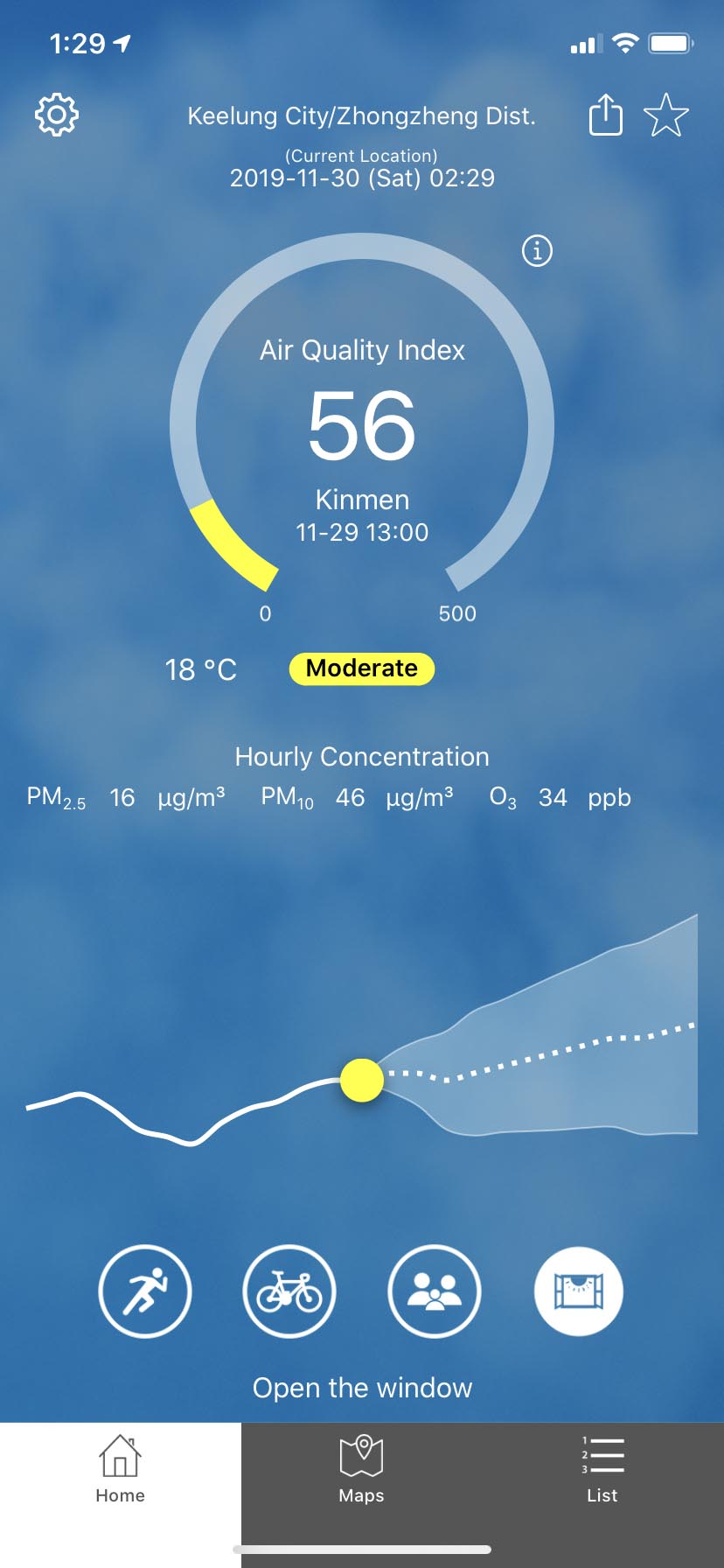
Home-Indoor Activities Suggestions
-
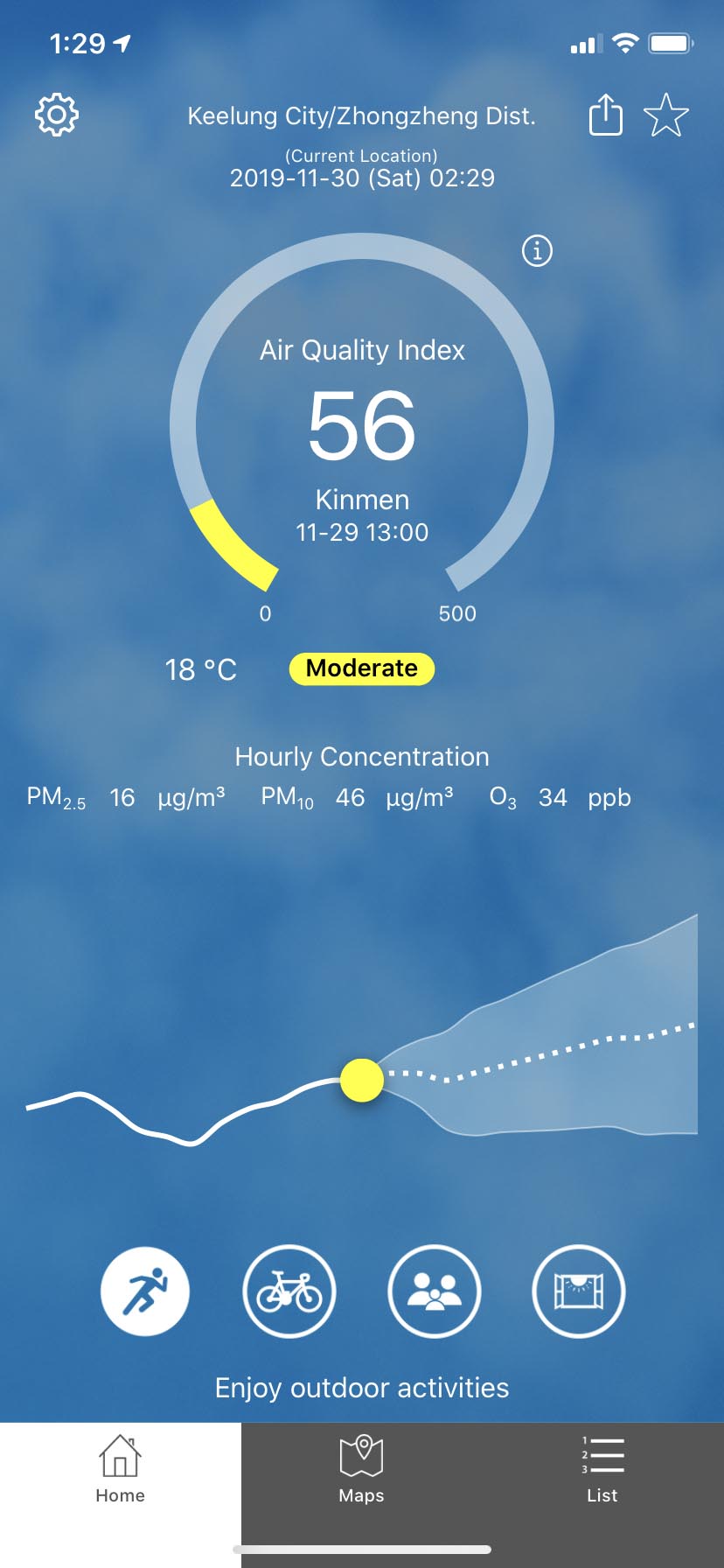
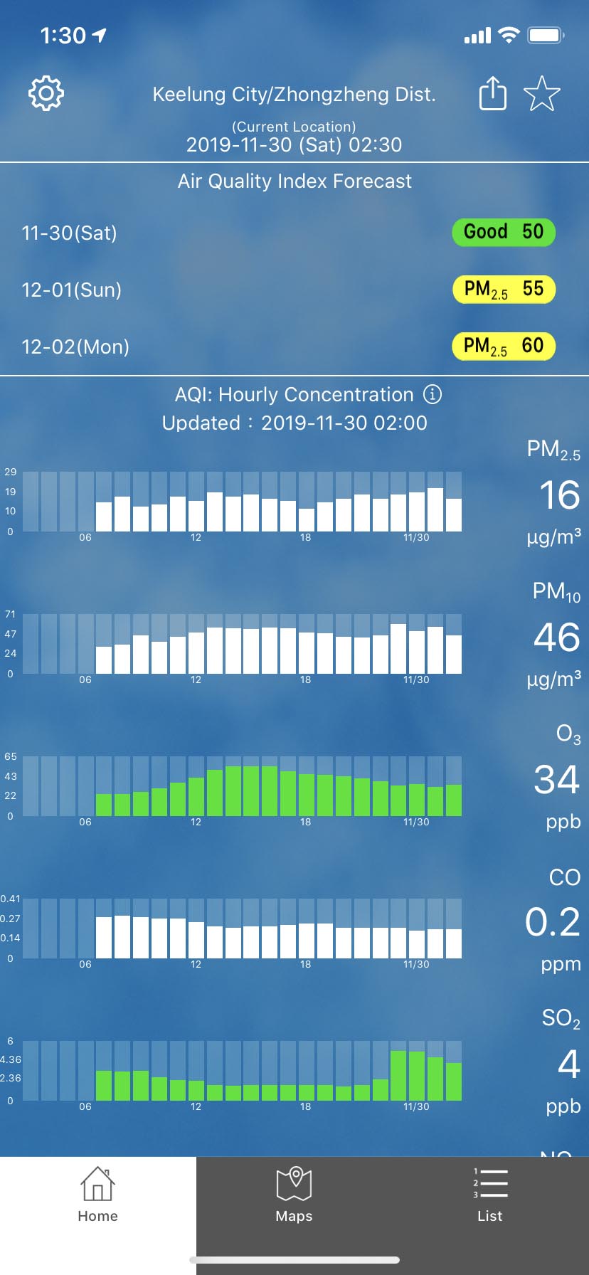
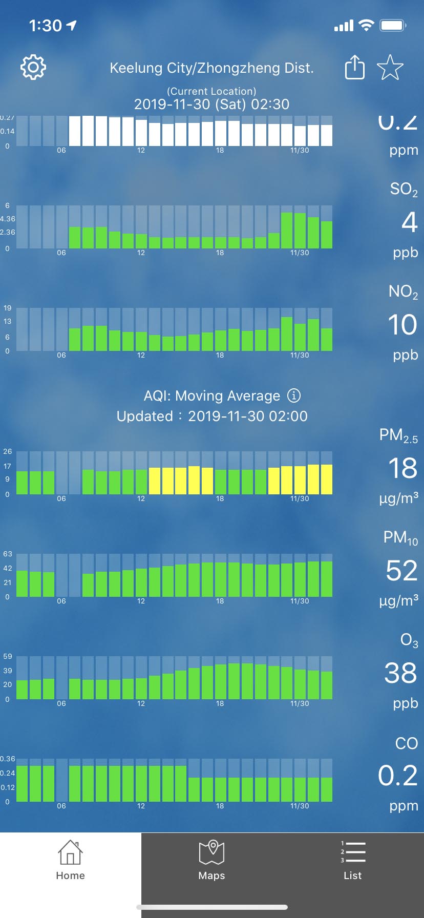
Home-AQI Hourly Concentration
-
Home-AQI Moving Average
-
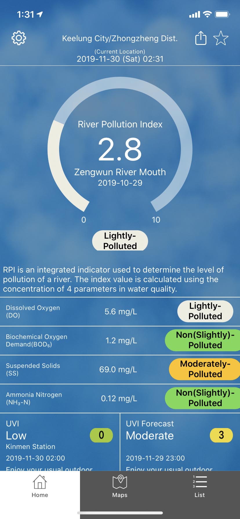
Home-River Pollution Index
-
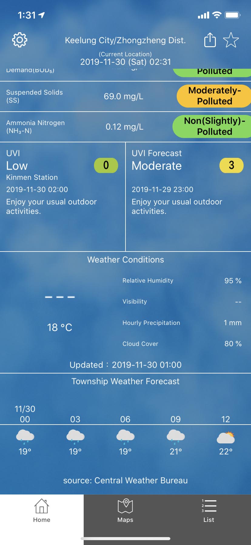
Home-Weather

-
Home-Current Location
-
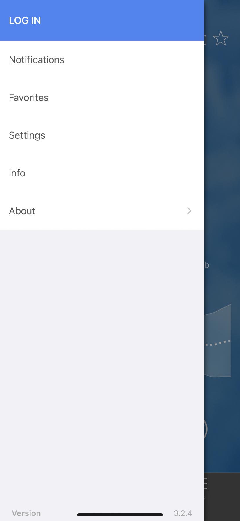
Home-Navigation Drawer
-
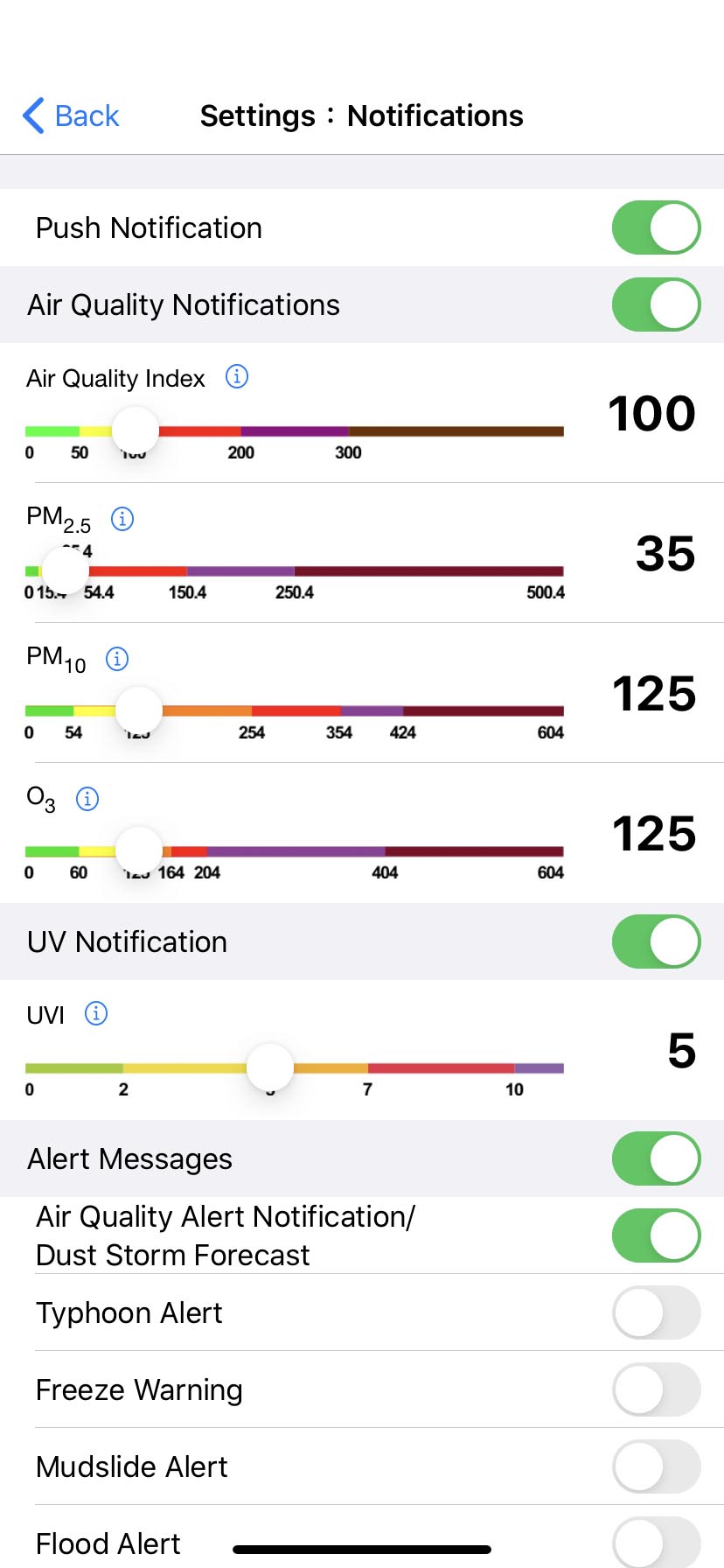
Notifications
-
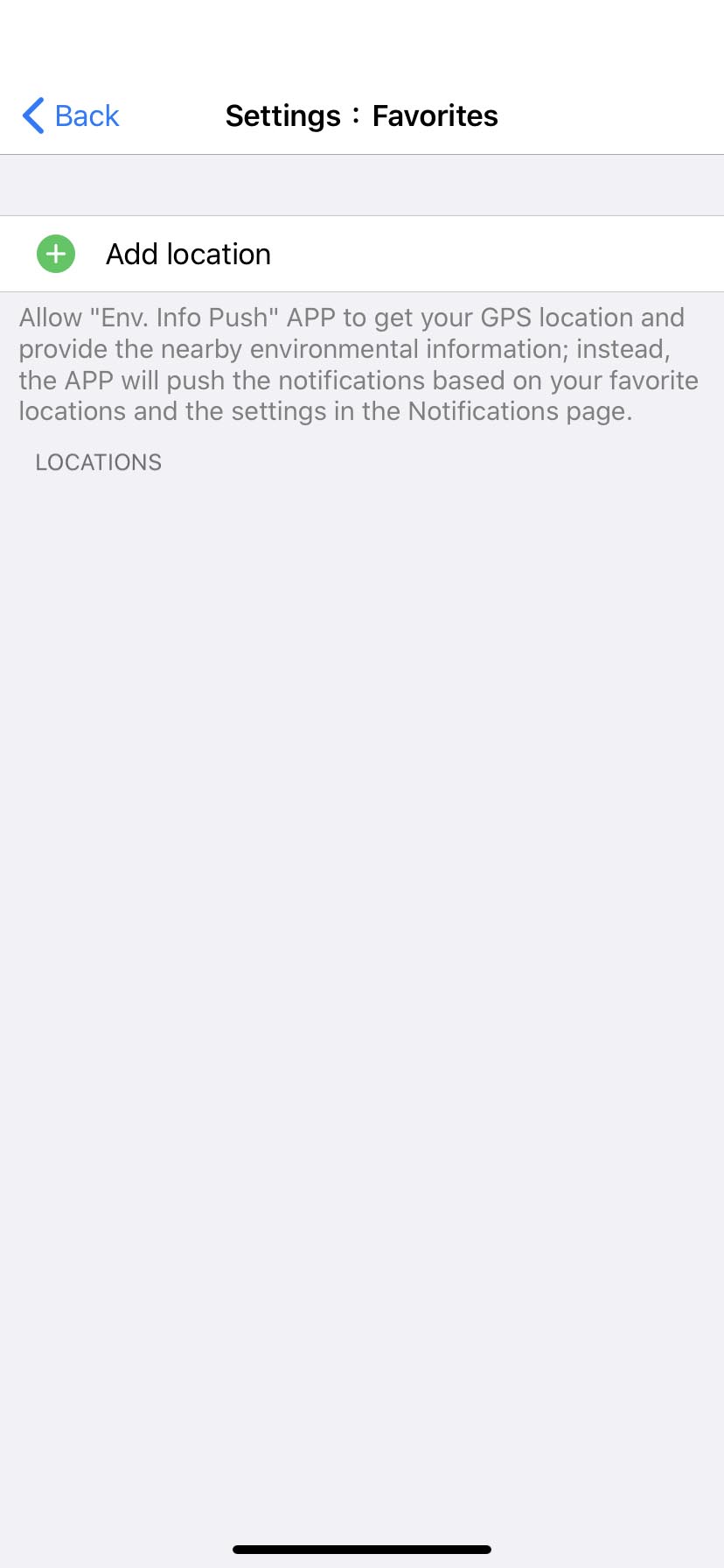
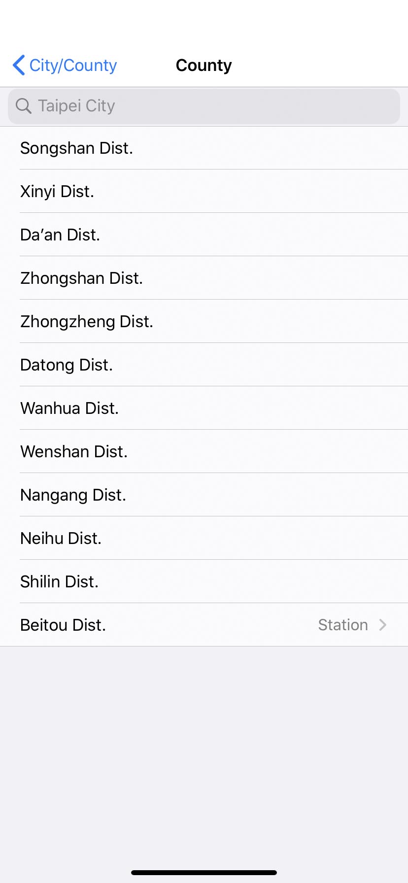
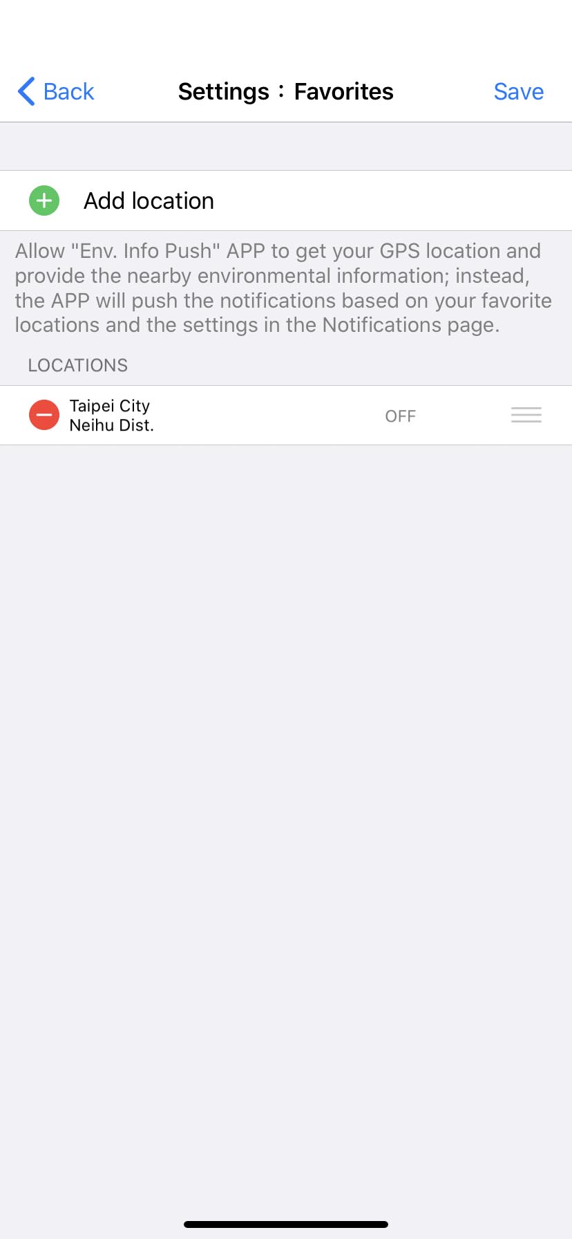
Favorites

-
Favorites
-
Favorites
-
Favorites
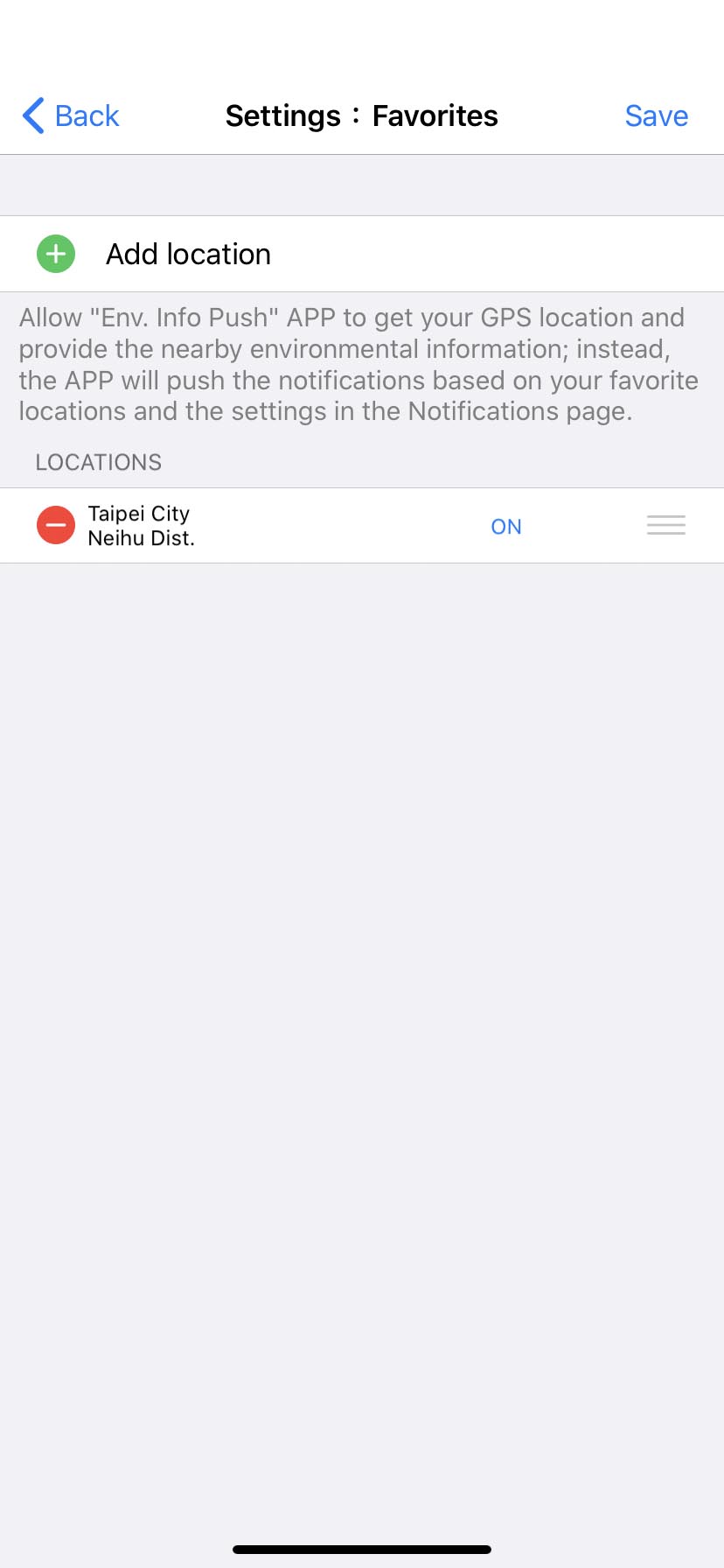
-
Favorites
-
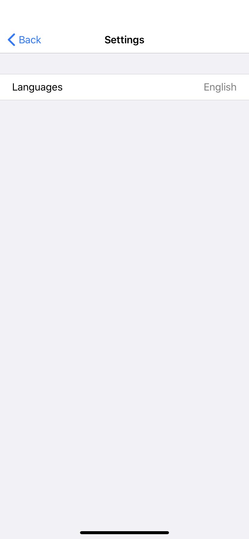
Settings
-
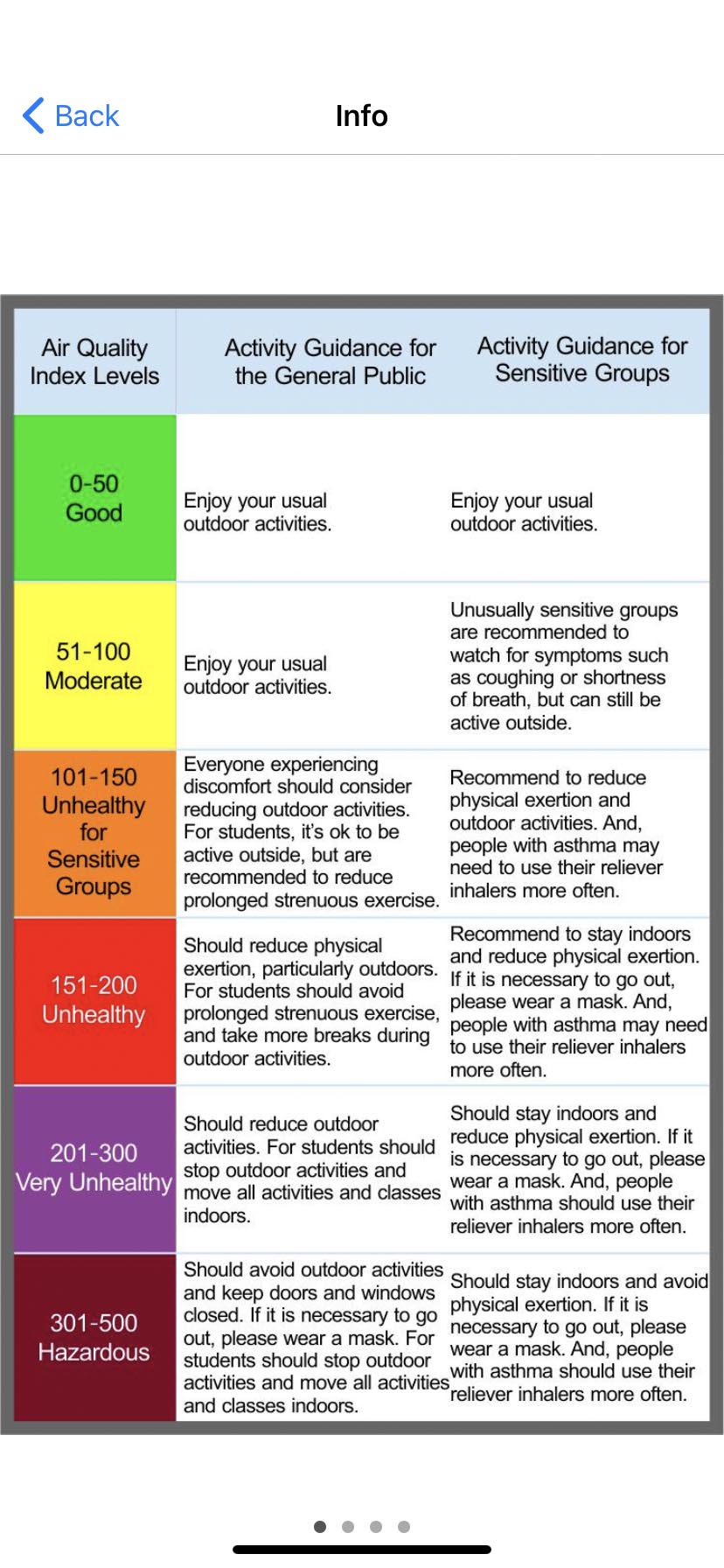
Info
-
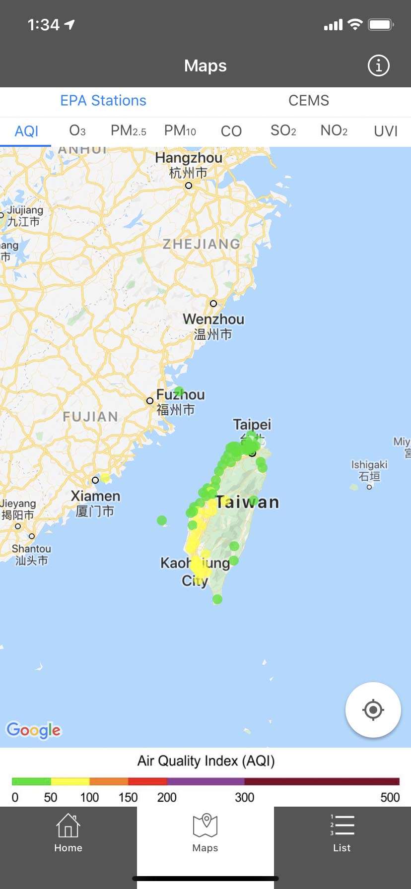
Map-AQI

-
Map-AQI
-
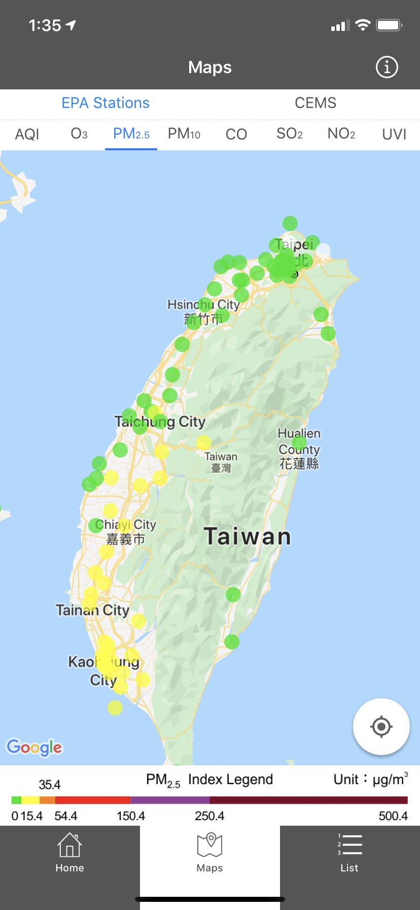
Map-PM2.5

-
Map-UVI

-
Map-CEMS OP
-
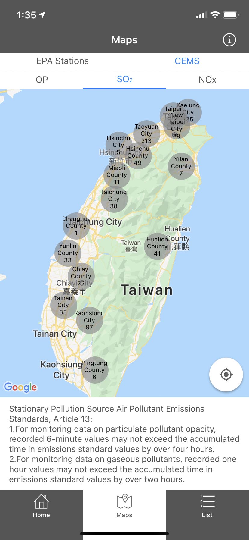
Map-CEMS SO2
-
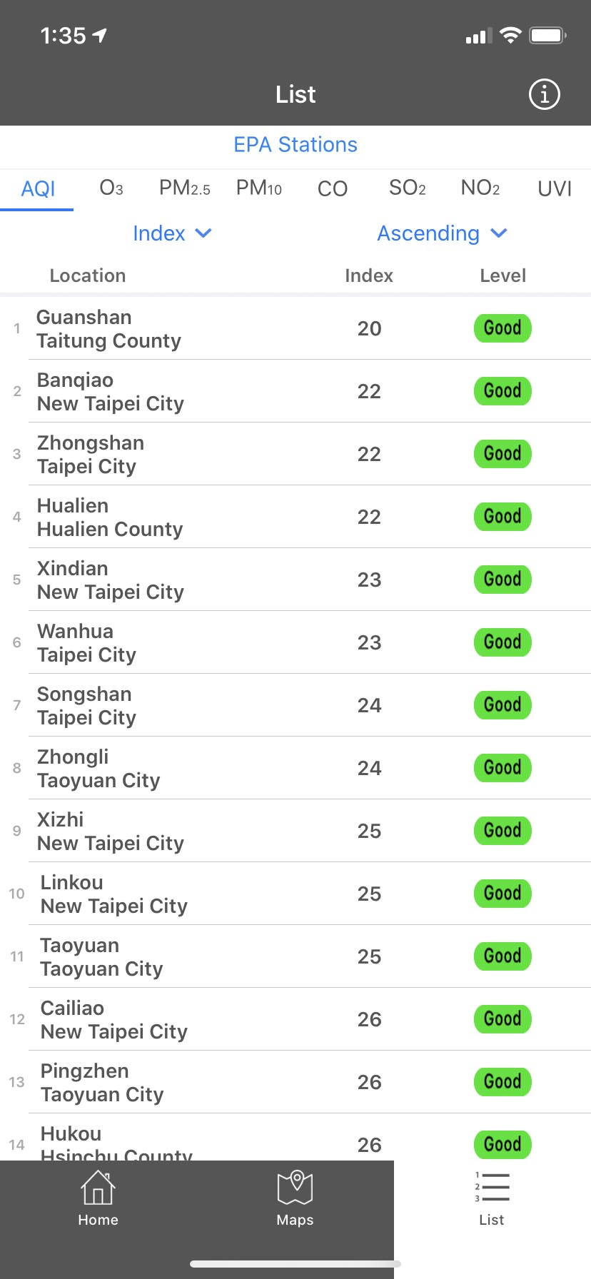
List-AQI

-
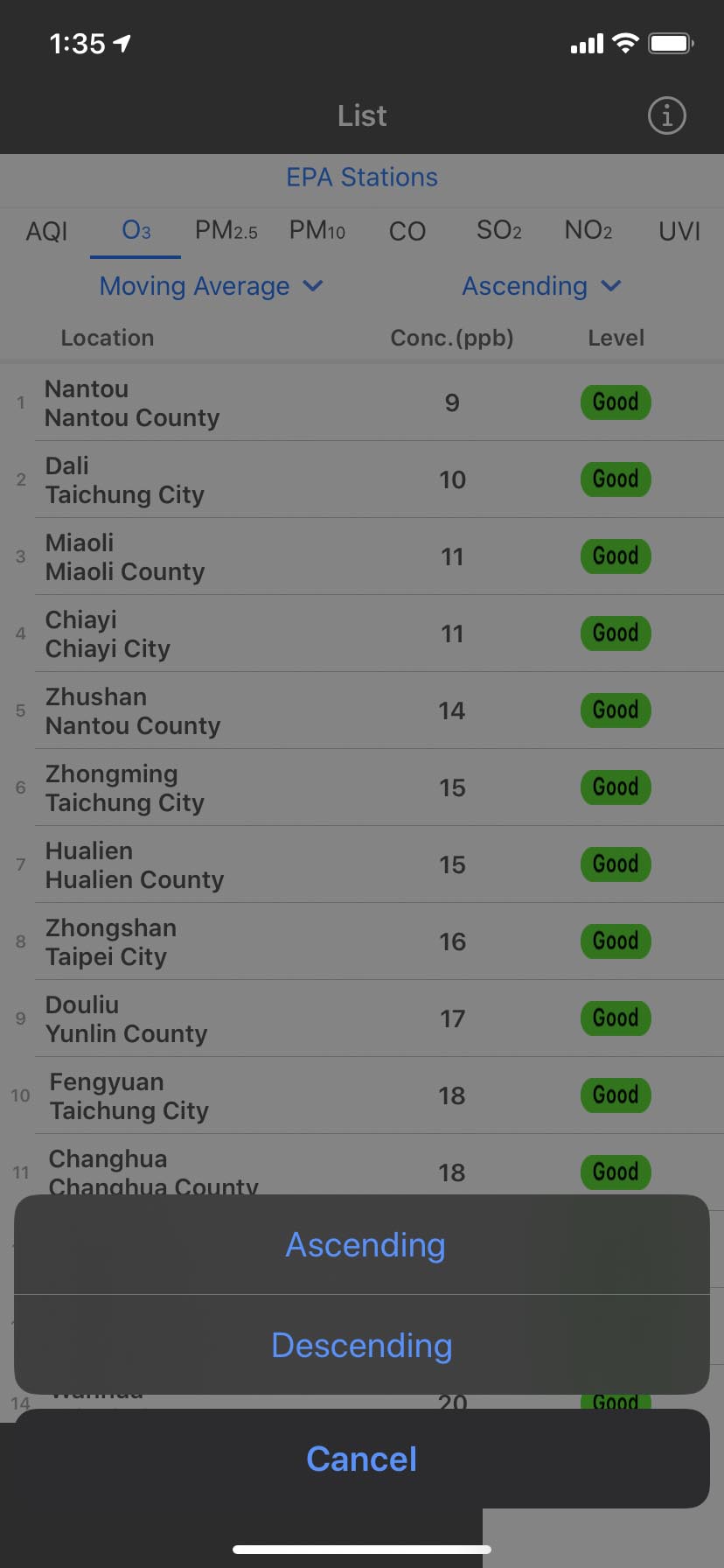
List-O3

-
List-Filter
-
List-Sort
CONCLUSION
Result
The app perfectly integrates eight different indices to show the real-time environment info, such as PM2.5, Pollutants Standard Index (PSI), Ultraviolet Index (UVI), River Pollution Index (RPI), weather forecast and etc., and displays in gauge and different colors, so that users can understand how serious it is, without knowing the complicated definition of those indices. The newly added Continuous Emission Monitoring Systems observation data helps users to watch particular pollutant sources, and avoid visiting specific polluted areas.
Users can also customize favorite spots and define their own alert standards to send push info. When any of the indices is over the self-defined or suggested standard, users will receive push notification immediately. In addition, the app also provides Map and List, two different ways to overview all the info by administrative zones. Meanwhile, the latest EPA news and other emergency alerts, like a tsunami, typhoon, mudslide, flood, earthquake, heavy rain, and sandstorm, will be sent to users’ devices to assist the public plan earlier.