OVERVIEW
About the Project
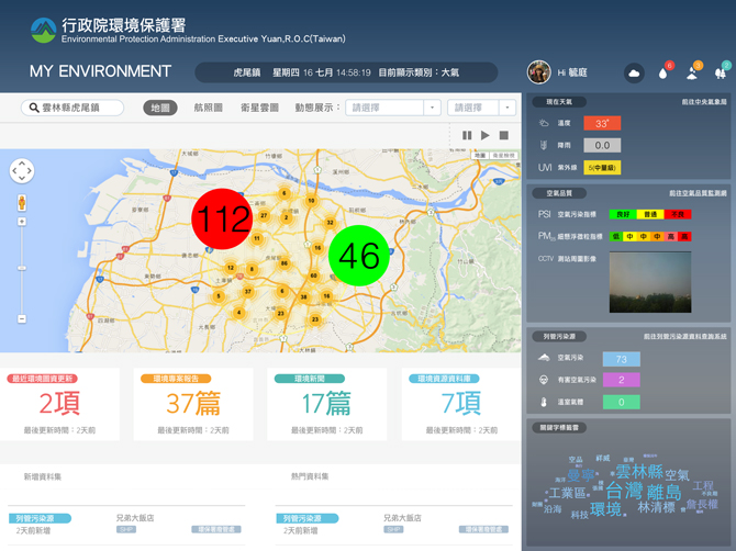
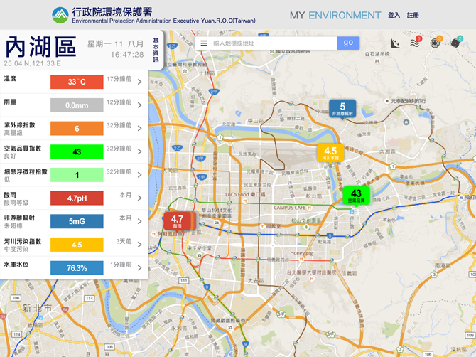
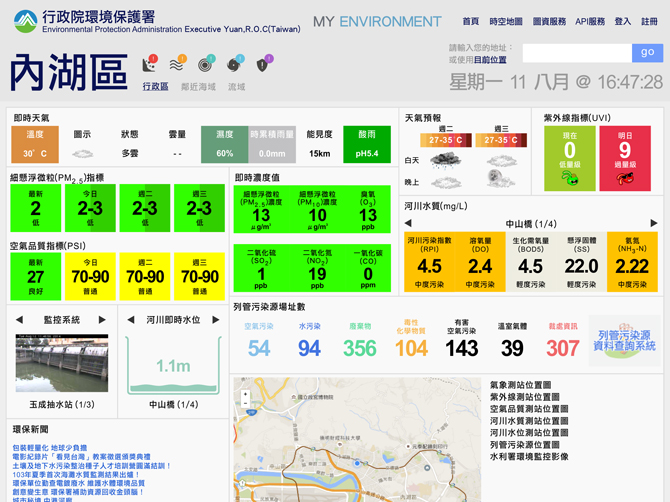
Through the Open Platform for Environmental Resources, Taiwan EPA compiles real-time monitoring information to create i-Environment - a thematic interactive map browsing platform to serve the demands of the public for this type of information. An interface with dashboards and interactive maps provides location-based services that allow users to easily browse and search the environmental information they need. Users can click the button of the dashboards to see the interaction on the map.
-
Role:
UI/UX Designer -
Tools:
Sketch, InVision, HTML, CSS, Bootstrap, Local-based service, Google Maps API -
Client:
EPA -
Timeline:
May 2015-November 2015
GOAL
The Challenge
Take the reference of the MyEnvironment portal of the US Environmental Protection Agency and EU practices, building map query service portal, which is integration, adaptability, theming, and personalization for public demand. Based on user-centered design, i-Environment provides environmental quality and life information according to the user's location.
RESEARCH
The Solution
In line with open data policy, the Environmental Protection Administration (EPA) continues to open up and promote public applications. "I-Environment" uses more than ten types of inter-departmental environmental open data in combination with location-based service. Users can grasp the environmental information effectively from searching location information. Through interaction map, user can also understand the surrounding environment. The personal environmental information map provides information based on the latest environmental activities from EPA and the local Environmental Protection Agency.
USER PERSONA
Understanding the User
IDEATION
Concept Sketching
HIGH FIDELITY DESIGN
Exploring Different Layouts
For example, if the user plans to celebrate the New Year'sYear's Eve around Taipei 101, they can use i-Environment to locate and view nearby environmental information and amenities like weather, public toilets, green stores, attractions, gas stations, and hospital, etc. Even the water quality of the nearby river and reservoir can be found.
CONCLUSION
Result
i-Environment is the first government website designed as the Hybrid Web. It helps present reports, statistics, quantitative figures, and other environmental information in data visualization. An interface with dashboards and interactive maps provides location-based services that allow users to easily browse and search for environmental information. In addition to the convenient information services, the sensor network also provides air quality alerts to the public, along with suggestions for appropriate activities, which is reminding the user of immediately responding to discomfort and risks from environmental pollution under various circumstances.


